Before visiting, please check the conditions of access.
 Walking/running/hiking
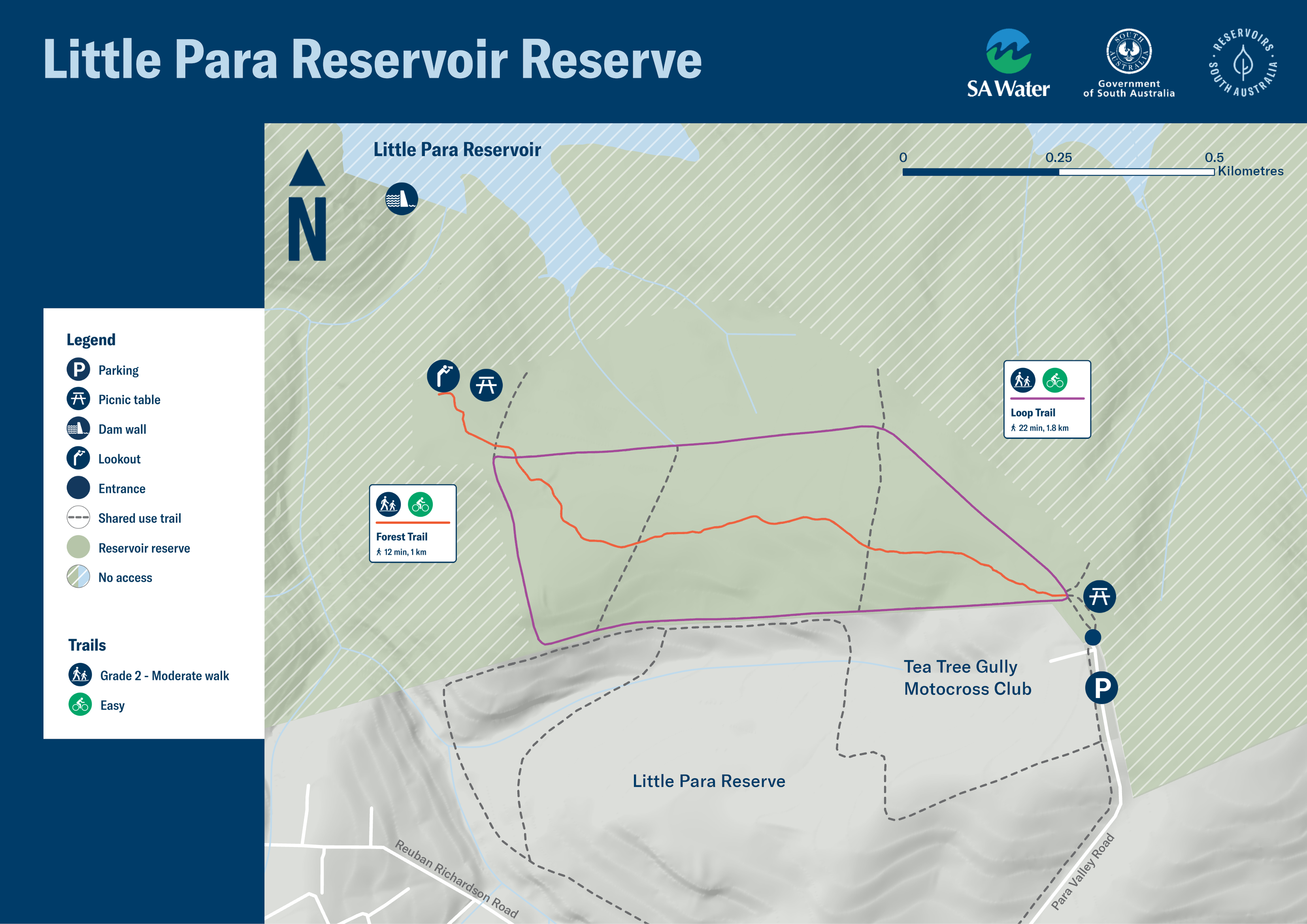
More than 3km of paths through native bushland and gentle rolling hills, including a 2km loop trail, provide an exciting addition to the local green spaces for nearby residents and the local community.
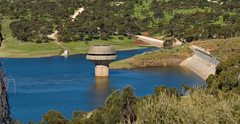
A lookout offers visitors a sweeping view across the reservoir towards the dam wall and down the valley.
 Cycling
Little Para offers cyclists a great side-track for adventure, with more than three kilometres of both easy and intermediate skill level shared trails to explore. Families looking for a picturesque spot to cycle together will also enjoy the trails and opportunities to stop and discover the local birds and wildlife.
 Picnicking
Little Para Reservoir Reserve provides trail seating and picnic areas, all perfect for enjoying a bite to eat. Or find a quiet grassy spot with views of the water to lay out your blanket for lunch.
 Getting there
The entrance to Little Para Reservoir Reserve is located at the end of Para Valley Road Greenwith, next to the Tea Tree Gully motocross track. This can be accessed by walking or riding through the adjacent Greenwith Little Para Reserve park,using one of the several entry points.
Little Para Reservoir Reserve has been designed for the local community to access on foot or by cycling, rather than by a vehicle. Limited parking is available.
![]() With the exception of assistance animals, dogs are not welcome at reservoir reserves as they can carry harmful organisms that can easily contaminate the water and present a risk to the safety of the drinking water. Dogs also pose a threat to local native birds and wildlife.
With the exception of assistance animals, dogs are not welcome at reservoir reserves as they can carry harmful organisms that can easily contaminate the water and present a risk to the safety of the drinking water. Dogs also pose a threat to local native birds and wildlife.
A print-friendly version of this map can be downloaded here.
Maps on your mobile
If you have a smartphone or tablet you can download the free Avenza Map app and have interactive reservoir reserve maps on hand when you need them.
The app uses your device’s built-in GPS to plot your real-time location within the reserve onto a map. The app can be used without a network connection and without roaming charges. You can also measure area and distance, plot photos and drop placemark pins.
How to get it working on your device:
1. Download the Avenza Maps app from the app store (iOS/Android) whilst you are still in range (its free!).
2. Open up the app and click the shopping cart icon.
3. Click ‘Find’ and type the name of the reservoir reserve you are looking for.
4. Click on the map you are after and install it (all our maps are free).
5. You will now find a list of your installed maps on the home page of the Avenza Maps app.
6. Use our maps through the Avenza Mapa app while in the reserve and never take a wrong turn again.


