To prepare for your visit, please check the conditions of access.
 Lookout
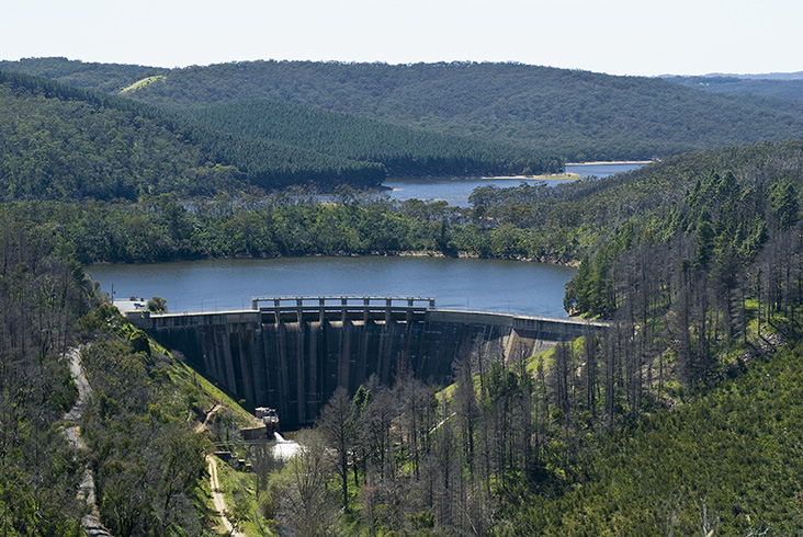
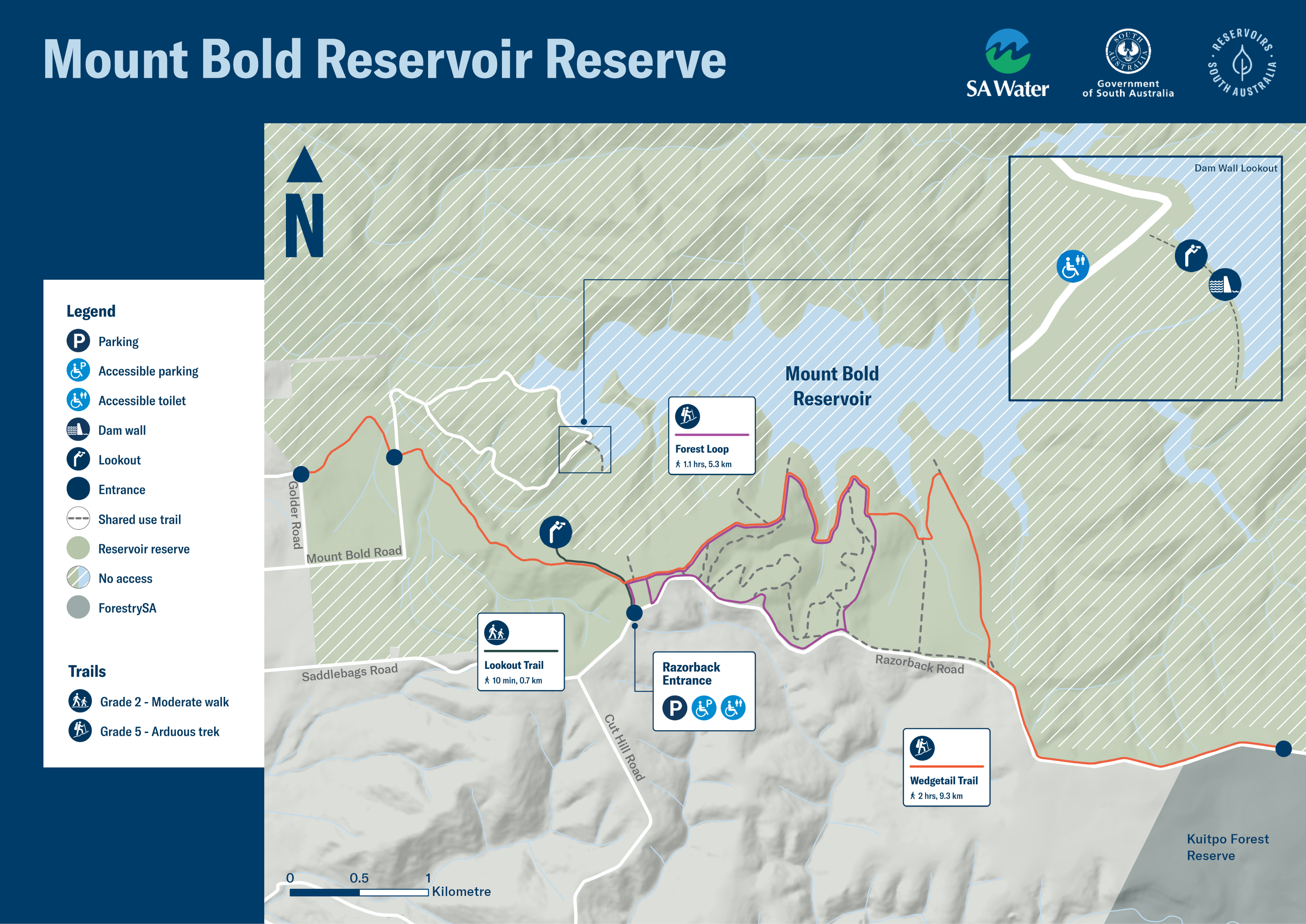
Mount Bold’s Razorback Rd viewing platform and lookout showcases panoramic views across the dam wall and over the Mount Lofty Ranges. It’s the prime stop for a glorious snap and to take in the ambience of this wonderful space.
The lookout area near the dam wall (open only between 9am – 4pm) gets you closer to the water; on most days you can walk to the other side of the dam wall and back.
 Walking/running/hiking
More than 13km of trails let you explore the southern section of the reserve on foot.
The Grade 2 Lookout Trail is unsealed, 1.4km return and takes you up gentle hills to a viewing platform.
The two Grade 5 hiking trails weave through a pine plantation and native vegetation, with sweeping views over the water, and with very steep and difficult hills they are suitable for experienced bushwalkers. The 5km Forest Loop takes you back to the car park, whereas the 9km Wedgetail Trail connects with the Kidman and Heysen walking trails, and the Onkaparinga National Park and Willunga Basin Trail for a more rigorous hiking experience.
 Picnicking
Pack a picnic basket complete with a blanket or chairs so you can sit back, relax and enjoy the lookout’s spectacular view.
 Wildlife and birdwatching
Take some time and see if you can spot some of the 160 native animals calling Mount Bold home, including the Southern Brown Bandicoot.
![]() With the exception of assistance animals, dogs are not welcome at reservoir reserves as they can carry harmful organisms that can easily contaminate the water and present a risk to the safety of the drinking water. Dogs also pose a threat to local native birds and wildlife.
With the exception of assistance animals, dogs are not welcome at reservoir reserves as they can carry harmful organisms that can easily contaminate the water and present a risk to the safety of the drinking water. Dogs also pose a threat to local native birds and wildlife.
Click map below for a print-friendly version.
You can check current reservoir levels at SA Water's website.
Maps on your mobile
If you have a smartphone or tablet you can download the free Avenza Map app and have interactive reservoir reserve maps on hand when you need them.
The app uses your device’s built-in GPS to plot your real-time location within the reserve onto a map. The app can be used without a network connection and without roaming charges. You can also measure area and distance, plot photos and drop placemark pins.
How to get it working on your device:
1. Download the Avenza Maps app from the app store (iOS/Android) whilst you are still in range (its free!).
2. Open up the app and click the shopping cart icon.
3. Click ‘Find’ and type the name of the reservoir reserve you are looking for.
4. Click on the map you are after and install it (all our maps are free).
5. You will now find a list of your installed maps on the home page of the Avenza Maps app.
6. Use our maps through the Avenza Mapa app while in the reserve and never take a wrong turn again.


